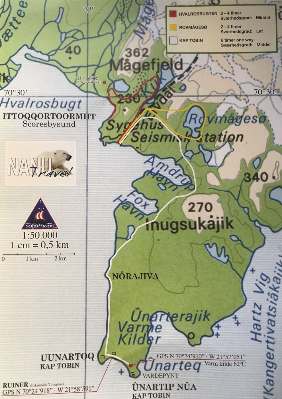
There is a hot spring with 62°C, sulphur-smelling water, about 1 km from the village. Uunarteq actually means ‘hot spring’ in East Greenlandic.
But because of the fog and the wind, I give up trying to find the spring, and decide to go back again, and now I also know the route better.
I head back out, and it’s really annoying with the icy cold wind. I come past Fox Harbor again and more into the shelter. I take the same snowdrifts up the mountain, but cross further to the left to save altitude, and it turns out to be a good decision, even though it’s still hard, with some climbing involved.
I reach the bottom of Amdrup Harbour, and this time I see the white triangles, which I follow (they are further away from the coast than on the way out). I make it to the river again, which needs to be crossed, and find a place 20-30 metres down from the source where I can cross with boots on, but I still get one boot completely full of water.
At some point, a female eider duck flies up, and I see the nest, built of the finest down, that can keep the four eggs warm.
Finally Ittoqqortoormiit comes into view, the sun is low, and I head down via a long snowdrift. Past the dogs, the radar station, down some stairs, over the bridge, up some stairs, and then I’m home again in the guesthouse. It is 3 am, and a fantastically beautiful but also physically demanding hike has come to an end.


 Getting to Ittoqqortoormiit is not easy or cheap. From Reykjavik and Akureyri in Iceland, there are 1-2 weekly flights to Nerlerit Inaat (


