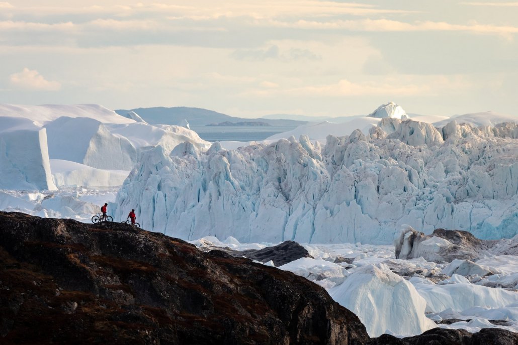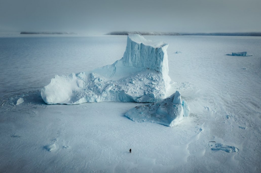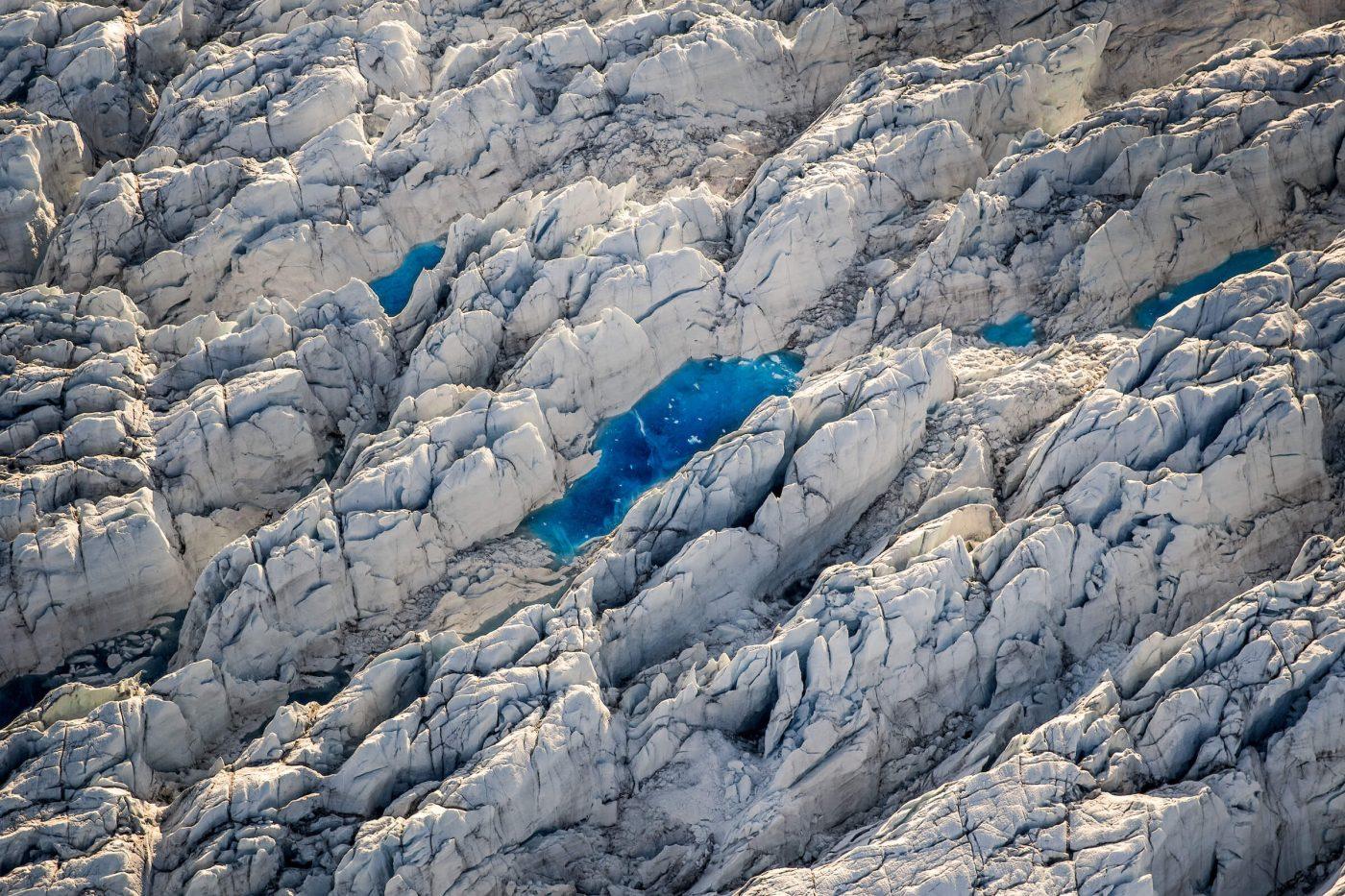
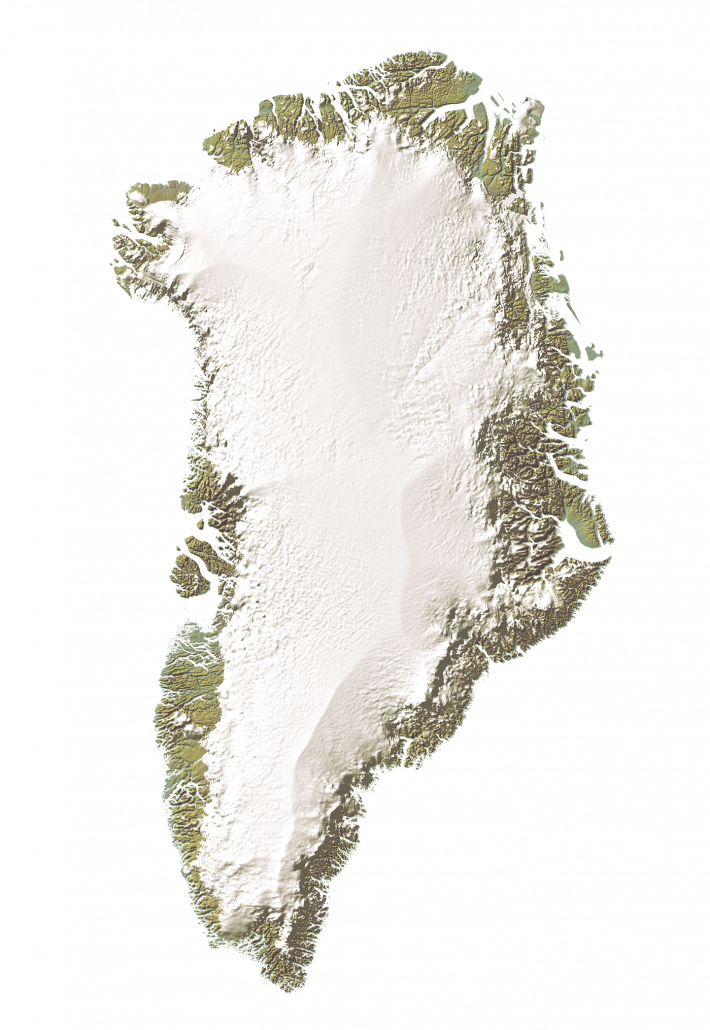
Approximately 80% of Greenland is covered in ice, largely made up of Greenland’s vast ice sheet which stretches from the island’s interior to the coastline. Whilst the ice in the interior can be as thick as 3200 metres, the ice sheet extremities can form breath-taking outlets and glaciers. Towering ice cliffs form where glaciers terminate into fjord water, and icebergs dramatically calve and disintegrate. Some glaciers terminate on land, creating vast streams that drain the outflowing meltwater across sweeping valleys.
In recent years, drastic changes have been observed under our warming climate, including changes in Greenland’s glaciers that flow into the ocean. Let’s have a look at some of these glaciers, what makes them special, and how they are changing.
* Jakobshavn Glacier and Qarassap Sermia are local names and have the same official name which is Sermeq Kujalleq.
KNS (Kangiata Nunaata Sermia)
KNS (Kangiata Nunaata Sermia) is the biggest ‘local’ glacier to the capital city of Nuuk being situated at the head of Nuup Kangerlua, also known as Nuuk fjord. Draining approximately 2% of the Greenland Ice Sheet, KNS is the largest ice sheet outlet in southwest Greenland. The glacier forms a substantial ice cliff where it enters the fjord water, covering approximately 4.5 km from one side of the fjord to the other.
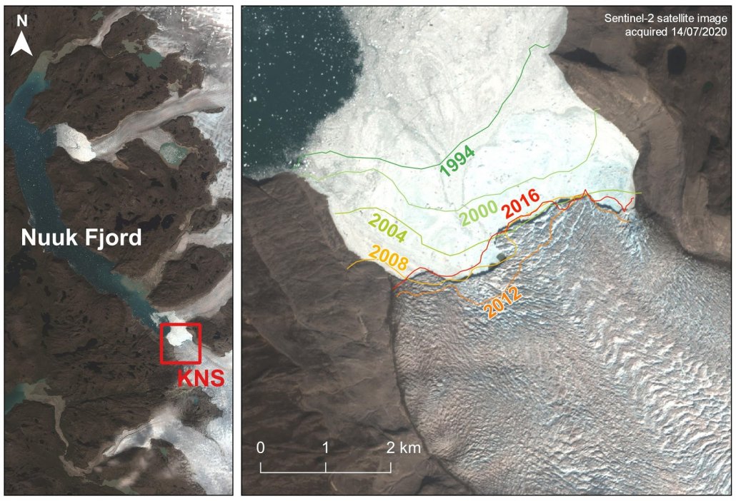
KNS glacier front positions from 1994 to 2016, showing its retreat inland over time. This information was collected from satellite imagery, where the glacier position could be identified as a satellite passed over the region. These positions were derived from multiple satellites by the European Space Agency (ESA) and the Climate Change Initiative (CCI), which produce large scale datasets from satellite products. The glacier front positions shown here are just one record of many glaciers in Greenland that they documented and identified front positions for.
Why is KNS special?
Compared to other Greenland glaciers, a lot is known about Kangiata Nunaata Sermia and how it has changed over time. It is one of Greenland’s rapidly vanishing glaciers, having retreated 22.6 km in the last three centuries. Up until the 1940s, KNS and its neighbouring glacier, Akullersuup Sermia, were joined and flowed into one another. More recently, the glacier front (also called its terminus) has receded two kilometres since 1994 as documented from satellite imagery (see picture), which is largely linked to variable climate conditions and exceptionally warm periods.
Sermeq Kujalleq (Jakobshavn Glacier)
With a reputation for being the fastest glacier in Greenland, Sermeq Kujalleq (also known as Jakobshavn Isbræ or Ilulissat Glacier) is a major outlet of the Greenland Ice Sheet, causing the sea level to rise by roughly 0.9mm globally between 2000 and 2010. It is situated at the head of Disko Bay in West Greenland, discharging gigantic icebergs into the fjord and partly why the major settlement nearby was named the Greenlandic for ‘iceberg’, Ilulissat.
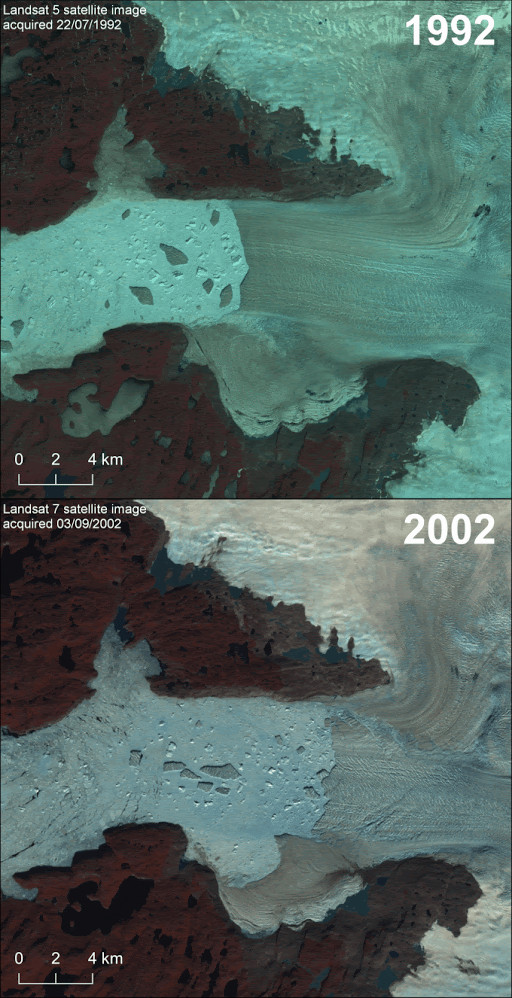
Two satellite images from Sermeq Kujalleq captured 10 years apart, from 1992 and 2002, documenting the disintegration of its floating glacier tongue. These satellite images are from the NASA/USGS Landsat program, which was first launched in 1972 and is one of the longest continuous satellite image records in existence.
Why is Sermeq Kujalleq special?
A big milestone in Sermeq Kujalleq’s lifetime was the disintegration of an 8 km section of its floating ice tongue between the late 1990s and early 2000s. During this period, ice discharge from Sermeq Kujalleq doubled and severely choked the fjord with icebergs. This disintegration is understood to be linked to significant ice thinning, increased speed of the ice flow, and the opening of large crevasses. Scientists have attributed this behaviour to warm subsurface ocean waters along the entire west coast of Greenland, enhancing glacier melting from beneath. Ocean temperature has been linked to observed changes at many glaciers that terminate into oceans, making the interface between ice and ocean a crucial environment for scientists to monitor.
Sermeq Kujalleq (Store Glacier) Local name: Qarassap Sermia
Qarassap Sermia (also known as Store Glacier) is a heavily crevassed glacier in the Uummannaq region of West Greenland. The glacier terminates into the southern end of the fjord, often discharging vast icebergs into the Uummannaq Fjord system. Such icebergs can be particularly hazardous to boats as they disintegrate and move through the water.
Helheim Glacier
Helheim Glacier is one of the biggest glaciers in Greenland together with Sermeq Kujalleq and Kangerlussuaq Glacier. It is also one of the most reputable glaciers in Greenland for producing icebergs, with spectacular displays of collapses at the glacier terminus. When glacier ice breaks off the front of a glacier this is called the process of glacier calving.
Calving events can be driven by a number of factors, producing all ranges of iceberg sizes in an array of manners – from break-offs at the top of the ice cliff to upwellings of ice from the submerged part of the glacier. Ice can explode and shatter as these big blocks of ice collapse into the fjord, spraying a large area in front of the fjord with lethal projectiles. This forms a tremendous sound that rumbles across the fjord, but not a sound you want to hear if you are too close to the glacier. Fatalities have occurred in instances where bystanders have been too close to calving glaciers, either from being hit by exploding ice shards and projectiles, or from the resulting tsunamis.
A large calving event was captured at Helheim Glacier in 2010 from time-lapse cameras by scientists at Swansea University in the UK. This style of calving is understood to be driven by buoyant flexure. In this instance, it is suspected that the difference in ice buoyancy across the terminus is caused by the glacier flowing into deeper water at a rate faster than it cannot adjust to.
Why is Helheim Glacier special?
Helheim Glacier has exceptional calving ice events, with calving occurring all year round. Catastrophic calving events have been witnessed, where the entire length of the glacier front appears to peel off and topple inwards, excavating icebergs in a bottom-out manner. This style of calving is driven by differences in ice buoyancy across the glacier tongue, which occur due to changes in sea bed topography or changes in ice thickness (talked about previously in the section on Sermeq Kujalleq). This buoyancy difference forms a point of flexion in the ice column, which is weakened over time through crevasse propagation from both the surface and the bed of the glacier to the point that the entire section shears off.
Sermerssuaq (Humboldt Glacier)
Sermerssuaq, also known by its foreign name Humboldt Glacier, is one of the widest glaciers in Greenland, stretching approximately 90 km and terminating into the Nares Strait in North Greenland.
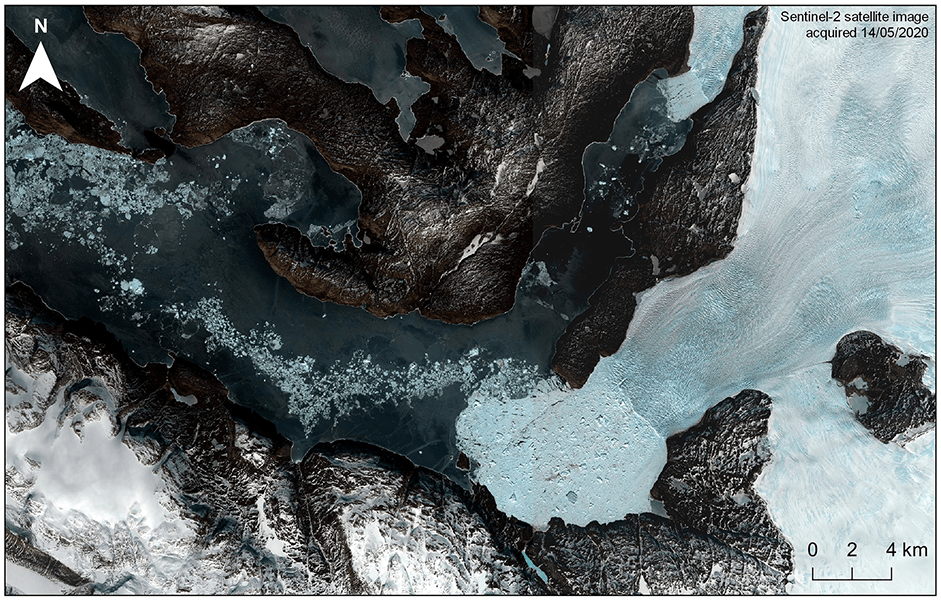
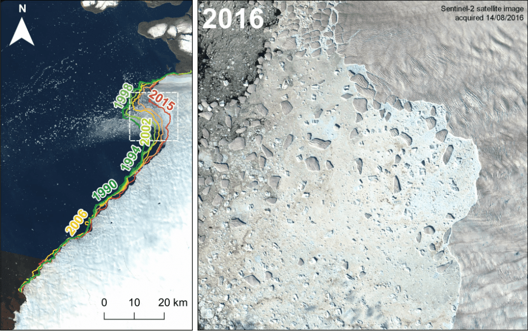
The satellite image on the left shows the retreat rate of Sermerssuaq, with annotations of the glacier position from 1990 to 2015 (defined by the ESA CCI Greenland Ice Sheet project). A close-up of the northern section of the glacier front shows its marked changes since 2016, retreating over a kilometre in some places.
Why is Sermerssuaq special?
Sermerssuaq or Humboldt glacier has generally been in retreat since 1975, likely linked to a significant warming trend in air temperatures. Interestingly though, the rate of retreat differs between the northern and southern section of the terminus. The northern section has retreated 147 metres each year on average, an order of magnitude greater than the southern section which has retreated an average of 15 metres per year between 1975 and 2012.
The difference in this retreat rate is driven by what is beneath the glacier. Airbourne surveys of the areas have revealed a deep trough over 300 m deep beneath the northern section of the glacier, which extends roughly 72 km inland. Meanwhile, the southern section of the glacier is lying on a comparatively shallow sea bed. At its present retreat rate, it is estimated that the northern section of Sermerssuaq will remain in this trough for 170 years, therefore this differing rate of retreat is likely to continue into the foreseeable future.